
www.technology4environment.com
19
'26
Written on Modified on
Multispectral imaging system design approved for satellite deployment
Raytheon develops a superspectral instrument suite to enhance global digital infrastructure for Earth observation.
www.rtx.com
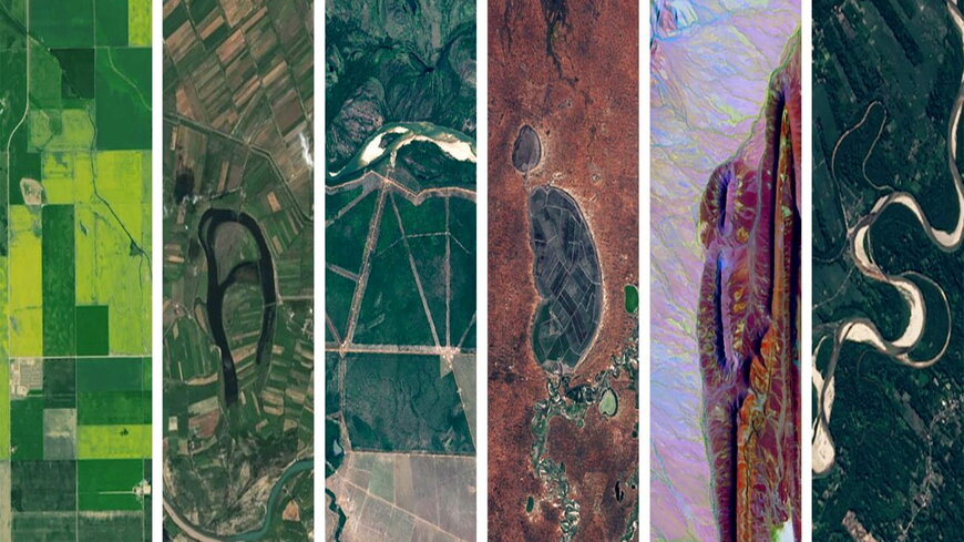
Raytheon, an RTX business, has successfully completed the preliminary design review for the National Aeronautics and Space Administration (NASA) Landsat Next Instrument Suite. This milestone validates the engineering architecture, algorithms, and technical approach for a new generation of space-borne imaging systems designed to monitor global land and environmental changes.
Technical challenge and cooperative scope
The Landsat Next mission requires a substantial advancement in data collection capabilities to support complex environmental analysis. Traditional imaging systems are limited in spatial and spectral resolution, restricting the precision of remote sensing data.
To overcome these constraints, NASA and Raytheon are cooperating to build a system that functions with a high level of technical maturity. Raytheon provides the core multispectral imager, engineering analyses, algorithms, fabrication, testing, and operational support, while integrating the suite into NASA’s broader space-based digital infrastructure.
Instrument architecture and specifications
The engineered technical solution shifts the platform from standard multispectral imaging to a superspectral classification. The architecture is designed to capture twice the number of spectral bands compared to previous generations, while simultaneously doubling the current spatial resolution.
The instrument suite utilizes optimized optical pathways and high-efficiency focal plane arrays to process the increased data load. Data processing algorithms developed by Raytheon manage the telemetry and sensor outputs, ensuring high signal-to-noise ratios and data integrity before transmission to ground stations.
Applications and industrial implementation
The enhanced data quality serves multiple professional and scientific applications. In agricultural engineering and industrial automation of resource management, the system optimizes crop production and soil conservation through precise spectral signatures.
Furthermore, the data enables advanced monitoring in the following areas:
- Water quality mapping and aquatic health assessment.
- Forestry management and biomass tracking.
- Climate modeling and snow dynamics research.
Deployment timeline
Following the successful design review, manufacturing and rigorous testing phases will proceed to ensure compliance with aerospace standards for orbital hardware. The first sensor suite is scheduled for delivery in 2028, ensuring the continuity of the longest-running satellite record of Earth's land surface.
Edited by Evgeny Churilov, Induportals Media - Adapted by AI.
www.rtx.com
Following the successful design review, manufacturing and rigorous testing phases will proceed to ensure compliance with aerospace standards for orbital hardware. The first sensor suite is scheduled for delivery in 2028, ensuring the continuity of the longest-running satellite record of Earth's land surface.
Edited by Evgeny Churilov, Induportals Media - Adapted by AI.
www.rtx.com
